-
I’ll add a disclaimer to the start of todays post. Its simply an observation and one take on how buildings can be perceived to follow society – not a challenge to anyones beliefs.
Looking back in history, within many societies, until the 1900’s most all of the worlds largest buildings were churches. Looking forward from there, they have largely dwindled in comparison to that of the skyscrapers full of business, marketing and sales. With some ad-lib to his work, I think back to my studies of Durkheim and his writings around The Elementary forms of Religious Life. In part of this work, Durkheim looked at Totems as a representation of society.
When we look back in history, with the church being the largest ‘totem’ of the community, one might come to the conclusion that the morals, systems of belief and ways of living mirrored that of the communities totem. A place of spiritual, and community energy. It was the hub of a small town/village/area where people got together and shared once a week – no doubt the place where networks, ties and business also occurred (at appropriate times).
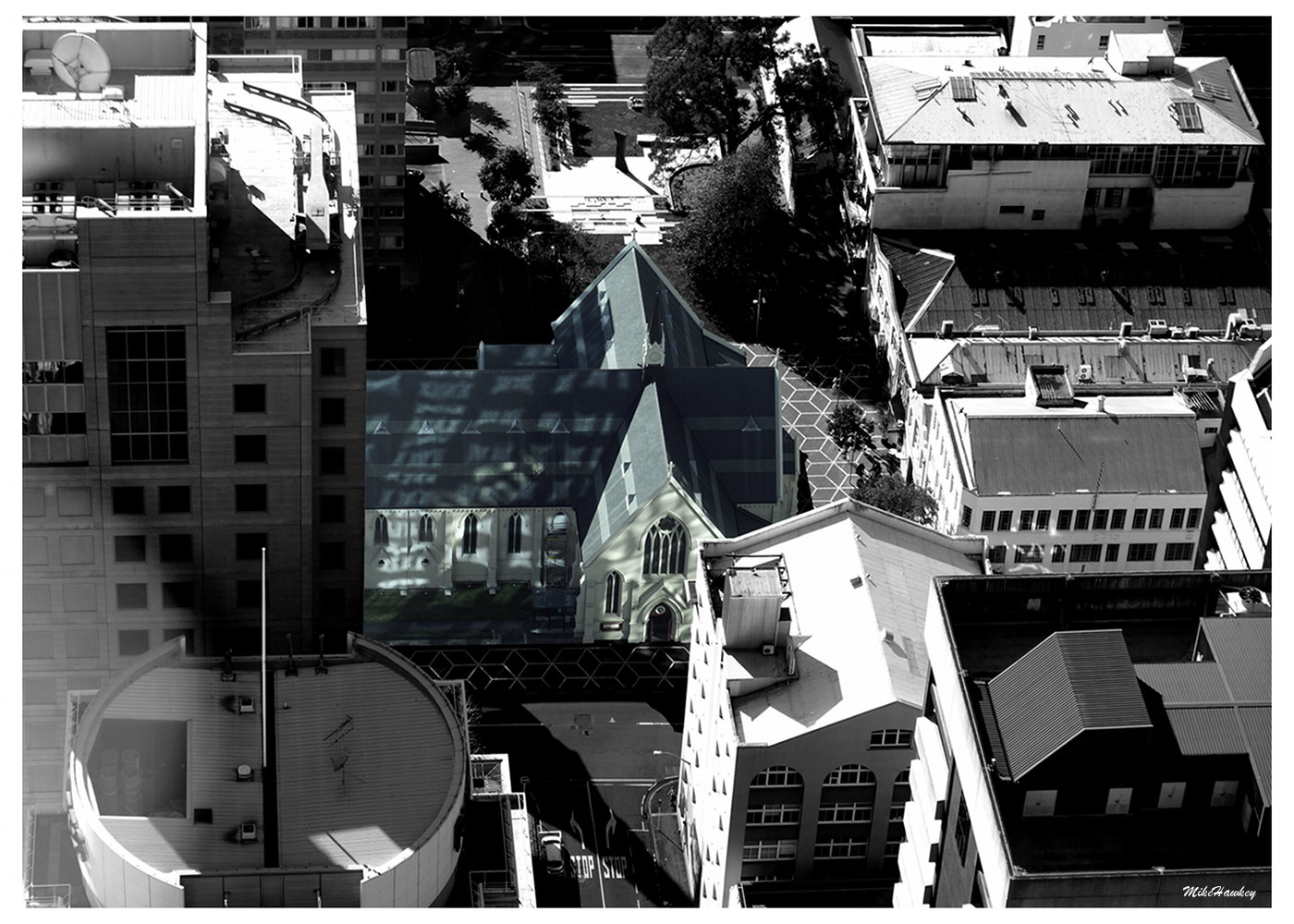
Move to ‘the Now’, and, again applying the same totem ideas, we are in a different space. No doubt peoples churches still hold true and important to many, but so too has the modern power of commercialism. Businesses and retail, their ‘totems’ rocketing into the sky, draw us as a society to flock to malls, -need, want, must have. No longer does one necessarily meet and network for some concept of a greater good, but rather to shop, or do business – to make money and get more things. Ok – well part of that argument is a little weak as without question people also networked for business and personal gain purposes at their old totem place in the last paragraph also.I’ll leave that discussion there for now, but it was brought on from todays image. The last from the Sky Tower I will share. Looking down upon the city with my lens zoomed right in, I spotted the St Patrick’s Cathedral in an opening of surrounding buildings. In post, I converted the surrounding areas to B&W and brought the colour down just a tad on the building also.
-
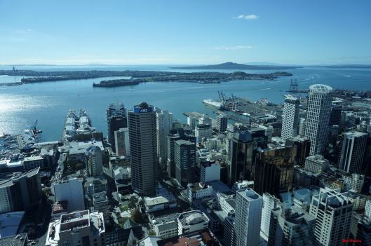
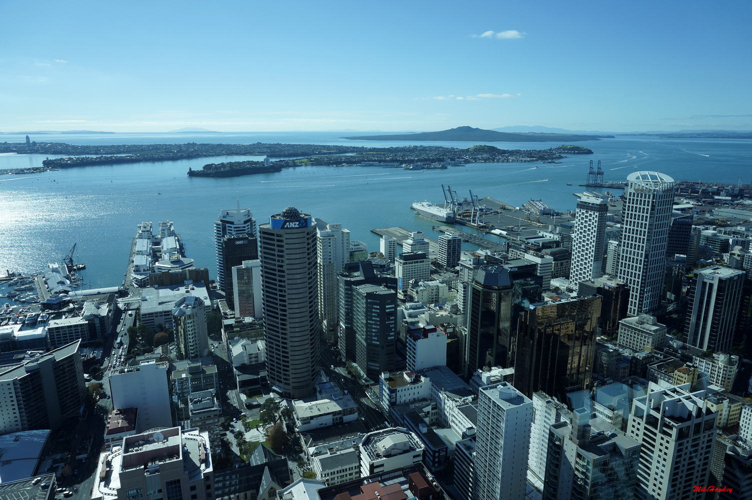
A beautiful clear day it was, todays image sees us looking out over the lower part of the city, across to Devonport on the North Shore, and beyond that Rangitoto Island (also a different part of the country way past that).
Rangitoto, a volcanic island, stands out in the Auckland landscape as the island that looks almost the same from any angle of Auckland. Its name, Maori, translates to Bloody Sky. Estimated to have largely formed 550-600 years ago (although possibly also over 1000 years intermittently). This recent forming (in the grand scheme of things), lives in the memory of local Maori, and evidence of human footprints between Rangitoto and its adjoining island Motutapu have been found.
Move forward a few hundred years from its creation, and into European settlement time, Rangitoto was purchased for the grand sum of 15pounds by the crown in 1854, and by the late 1800’s had become a popular day trip location (and a growing batch/alternative community). Further building was banned in the late 1830’s, and today only a small number of houses remain in this park area.
A great place to visit while one stays in Auckland – if you do go, remember to take a water bottle with you. Naturally sparse in water supply, walking up the volcanic path to the summit (unless you get the tractor) the climate is often hot and dry.That concludes my wider views from the Sky Tower for now. Really a must do for visitors to Auckland – simply to soak in the views of the countries largest city.
-
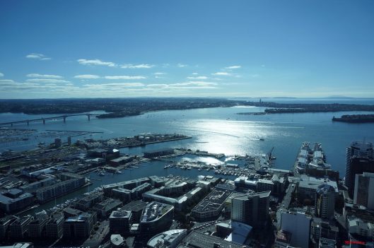
Looking to the North of Auckland, we can see the Auckland Harbour Bridge to the left of the image. Crossing that, we reach Aucklands North Shore. Prior to the bridge being completed in 1959, the North Shore, although in clear line of sight, was actually a fairly large land journey to reach the Auckland City area. A number of ferries ran services (and passenger ones still do), but the area was of relatively low population prior to the bridge – being used both for the rural community, and a weekend holiday area for its stunning beaches.
Upon the opening of the bridge, the population steadily boomed. Within the first decade of the opening, the bridge use was three times that of the original forecast, and by the end of the decade, the ‘Nippon Clip-ons'(named from their Japanese construction) were made, adding two extra lanes each side. Originally given a 50 year lifespan, ongoing maintenance ensures they are stretching that life estimate to its limit! – large/heavy trucks and machinery are no longer permitted on the clip-ons.
All the while this was happening, the North Shore was growing in population. With a size of ~130 square KM, the population is somewhere in the region of 230,000 (although census results should be available later this year). -
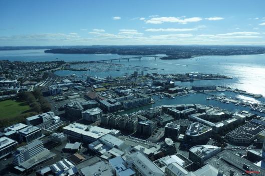
Looking out from the Sky Tower we see the view of the CBD’s viaduct. Out beyond that one of the large marinas the make Auckland New Zealand’s ‘City of Sails’. Beyond that, the Harbour Bridge, and the western side of the North Shore.
The Viaduct, once a more commercial area, has been redeveloped over the last decade or so into a up market apartment, bar and restaurant, and tourism area. Home to a number of very flash sea going vessels the size of a large home (and bigger), it is still being developed into a new upcoming area walking distance from the central business area.
The marina – Westhaven Marina, is the largest of its type in the Souther Hemisphere,and one of 640 worldwide brings about our title of the City of Sails.
Some more tomorrow!