• Opunake BeachA drive further along from yesterdays post took us to Opunake. Without meaning offence, as with many townships around NZ (well…the world), its one of those ‘blink and you miss it’ places. A small, and nice township, first surveyed (by westerners) in 1868.

    Stopping in for a packed lunch, the waves were strong. Typical of these west coast areas. A number of people were fishing off the beach, although with no success in the time we sat and watched as we ate our sandwiches.

    I didn’t really spend much time in the township, but for anyone passing through, have a look ‘here’.

    As with others – shot on the GRD IV and resized in Gimp.


  • Oakura BeachJust to the left of yesterdays image (about 15km down the road actually) lies the seaside surf escape of Oakura Beach. Easter weekend in New Plymouth happened to also have a VW club meet on, so it was quite cool to see a good handful of well kept and restored Kombi van’s parked up along the beach, as their owners surfed (or swam) the waves.

    Of interesting note, the township was hit by a tornado in 2007.

    Image wise, I desaturated the blue from the sky and slightly pushed contrast before cropping. All done in Gimp, and shot on the Ricoh.


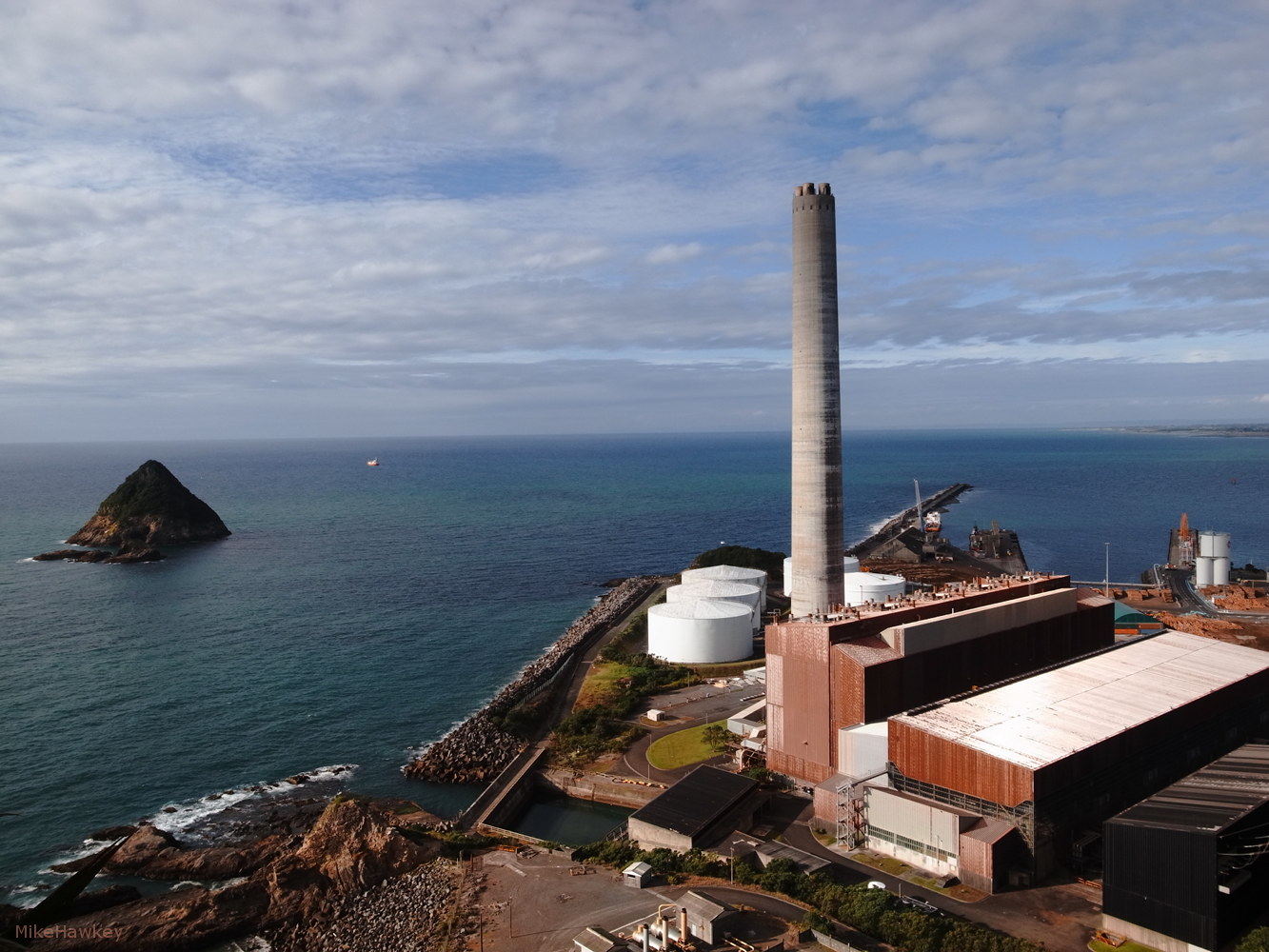
  • View from Paritutu SummitOne of my favorite shots from last weeks holiday in New Plymouth is from Paritutu – a tall headland point to one side of the main township. Looking down, under a falling sun I captured this image of the old power station, and offshore island.

    The power station, a natural gas/fuel oil station was opened in 1974, and decommissioned in 2008. Asbestos discovery was noted as one of the reasons for the closure (NZ has widely banned any new use of asbestos for several years now, and its often very costly to deal with in old homes etc).

    Off shore was see Sugarloaf island. The remainder volcanic vent piece from an estimated 1.7 Million years ago. Now part of a protected Marine area.

    Shot on the GRD, resized in Gimp.


  • Te Henui CemetaryDuring my stay in New Plymouth, one afternoon (~3 hours of it) was spent walking and exploring the Te Henui Walkway. Starting from the coast, it follows the river and weaves up through suburbia, a small bush covered belt.

    Half way along we hit the cemetery. I was surprised to see so many war veteran graves, mounted in beautiful symmetry over the wavy ground. As far as cemeteries go, it was a beautiful restful spot.

    At the edge, the track again dove into the bush and remet the river. I followed it up until suburbia took over, and I was back on the road.

    Shot on the GRD, resized in Gimp.


  • Brooklands ParkAs shot from the camera, I loved the saturated colour I got during my visit to Brooklands Park in New Plymouth. The sun was hot and the grass dry in many places.

    Brooklands itself is a suburb in New Plymouth. With a large area covered in the forested park (and a zoo), the area is (like many places in NZ) named from the old Brooklands Farm established in 1842. Its also home to the only Lawn Bowl’s Museum – anywhere apparently  (I didn’t visit it 1. due to not knowing this until after, 2. It was easter, so unlikely it would have been open).

    Shot on the GRD, resized in Gimp.

    More New Plymouth area tomorrow.